While America’s national parks attract record-breaking visitation, thousands of equally compelling landscapes remain comparatively uncrowded. From national monuments and state parks to wildlife refuges and scenic byways, these destinations offer dramatic scenery, outdoor recreation, and regional character without peak-season congestion. Understanding where to look—and how to plan—opens a broader, more flexible map of American exploration.
Why Look Beyond the National Parks?
America’s national parks are widely celebrated—and increasingly busy. The National Park Service reported more than 325 million recreation visits in recent years, with flagship destinations like Yellowstone National Park and Yosemite National Park experiencing significant peak-season congestion.
For many travelers, this raises a practical question: Are there equally rewarding landscapes without the same level of crowd density?
The answer is yes. The United States manages millions of acres of public land outside the national park system—through national monuments, national forests, state parks, Bureau of Land Management (BLM) lands, wildlife refuges, scenic rivers, and coastal preserves. These landscapes often provide comparable geology, wildlife, and recreational access, but with greater flexibility and fewer restrictions.
Exploring beyond the marquee names doesn’t mean lowering expectations. In many cases, it means expanding them.
What Counts as “Lesser-Known” Public Land?
When Americans search for alternatives to popular parks, they often ask:
- “What are the best hidden natural places in the U.S.?”
- “Are state parks better than national parks?”
- “Where can I go hiking without crowds?”
- “What are underrated scenic places in America?”
Lesser-known landscapes typically fall into these categories:
- National Monuments
- National Forests
- State Parks
- National Wildlife Refuges
- Scenic Byways and river corridors
- BLM-managed lands
These areas frequently border or surround major parks but operate under different management structures, allowing for broader recreational access and often more spontaneous planning.
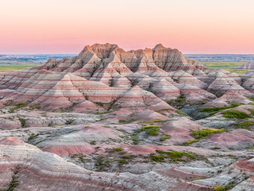
National Monuments: Big Landscapes, Smaller Crowds
National monuments protect landscapes of historic, cultural, or scientific importance. Some are well-known, but many remain overlooked compared to nearby national parks.
For example, Grand Staircase-Escalante National Monument offers vast canyon systems, slot canyons, and desert formations comparable to larger parks in Utah—yet it spreads visitors across nearly two million acres. Similarly, Craters of the Moon National Monument provides dramatic volcanic terrain without the scale of visitation seen at more famous western parks.
Why travelers appreciate monuments:
- Fewer timed-entry systems
- Easier parking access
- Broader dispersed camping options
- High-quality geology and hiking
For those planning a Utah road trip, substituting part of a Zion itinerary with time in Grand Staircase can significantly reduce wait times and shuttle lines while preserving scenic value.
State Parks: Local Stewardship, National-Scale Beauty
State parks collectively protect millions of acres of land across the country. Many offer landscapes that rival national parks in ecological diversity.
Consider:
- Silver Falls State Park — Known for its “Trail of Ten Falls,” offering waterfall density comparable to parts of the Pacific Northwest’s most popular parks.
- Custer State Park — Home to free-roaming bison herds and granite spires reminiscent of nearby Black Hills attractions.
- Dead Horse Point State Park — Overlooking the Colorado River with views often compared to Canyonlands.
State park systems vary widely in funding and amenities, but many provide:
- Lower entrance fees
- More accessible camping reservations
- Shorter entrance lines
- Family-friendly trail networks
Travelers frequently discover that weekday visits to state parks deliver the quiet experience they hoped to find in more crowded destinations.
National Forests: America’s Largest Outdoor Playground
Managed by the U.S. Forest Service, national forests cover nearly 193 million acres—more land than the entire state of Texas. Unlike national parks, forests prioritize multi-use access, including hiking, camping, fishing, and in some cases, off-road recreation.
For example:
- White Mountain National Forest offers alpine scenery and fall foliage rivaling more famous northeastern destinations.
- Sawtooth National Forest provides rugged peaks, alpine lakes, and backcountry trails without heavy infrastructure.
National forests are particularly appealing to travelers seeking:
- Dispersed camping
- Fewer commercial tour groups
- Flexible access points
- Backcountry solitude
However, they require more planning. Services may be limited, and travelers should carry appropriate maps, water supplies, and emergency gear.
Wildlife Refuges: Quiet Observation Over Spectacle
The U.S. Fish and Wildlife Service manages more than 560 national wildlife refuges. These lands prioritize habitat conservation but welcome responsible public access.
Bosque del Apache National Wildlife Refuge is renowned among birdwatchers for its seasonal sandhill crane migrations. J.N. “Ding” Darling National Wildlife Refuge provides coastal wildlife viewing without the density of Florida’s major beach cities.
Wildlife refuges are especially attractive for:
- Photography
- Bird migration seasons
- Scenic drives
- Educational programming
They often operate under quieter visitation patterns compared to nearby recreation-heavy parks.
Scenic Byways and Water Routes
Sometimes the most compelling landscapes aren’t confined within park boundaries. Scenic highways and protected river systems create travel experiences defined by movement rather than fixed viewpoints.
The Blue Ridge Parkway connects mountain communities across 469 miles, offering overlooks, hiking trails, and cultural stops without requiring a central entrance gate.
Similarly, designated Wild and Scenic Rivers—protected under federal law—preserve water corridors ideal for kayaking and fishing.
Road trips through these landscapes allow travelers to:
- Spread out across multiple access points
- Avoid concentrated visitor centers
- Integrate small towns and local businesses
- Adjust itineraries based on weather or traffic
How Do You Find These Places?
Travelers often ask: How do I discover lesser-known public lands near me?
Start with official sources:
- National Park Service (for monuments and historic sites)
- U.S. Forest Service interactive maps
- State park websites
- Bureau of Land Management land-use maps
- Fish and Wildlife refuge listings
Search terms like “best state parks near me,” “national forest camping,” or “less crowded hikes in [state]” frequently yield overlooked options.
Outdoor recreation platforms also provide user reviews and seasonal trail updates.
When Is the Best Time to Visit Lesser-Known Landscapes?
Timing matters just as much as destination choice.
General patterns:
- Spring and fall provide moderate temperatures and lower visitation
- Early morning arrival reduces parking congestion
- Midweek visits improve campsite availability
- Shoulder seasons offer better wildlife viewing conditions
For example, fall foliage in national forests across New England can rival national park displays—with significantly more space to explore.
Planning Considerations for Responsible Travel
Exploring beyond major parks requires preparation.
Keep in mind:
- Cell service may be limited
- Rescue response times may be longer
- Weather conditions can shift quickly
- Amenities such as restrooms or water stations may not be available
Responsible practices include:
- Carrying offline maps
- Following Leave No Trace principles
- Checking fire restrictions
- Respecting wildlife distance guidelines
These landscapes reward preparedness.
Frequently Asked Questions
1. Are state parks as scenic as national parks?
Many are. Scenic quality depends more on geography than designation.
2. Are lesser-known landscapes cheaper to visit?
Often yes. Entrance fees are typically lower or nonexistent.
3. Is camping easier outside national parks?
In many cases, yes—especially dispersed camping in national forests.
4. Are these areas safe for families?
Yes, but infrastructure varies. Research trail difficulty and services in advance.
5. How crowded are national monuments?
Some are busy, but many receive a fraction of the visitation of flagship parks.
6. Do wildlife refuges allow hiking?
Many do, though access may be limited during sensitive seasons.
7. Can I visit these places year-round?
Access depends on weather and road conditions.
8. Do I need permits?
Some activities require permits; always verify with managing agencies.
9. Are there guided tours available?
Some forests and refuges offer ranger-led programs seasonally.
10. How do I support conservation when visiting?
Pay entrance fees where applicable, donate to park foundations, and follow responsible recreation guidelines.
Redrawing the Map of American Exploration
America’s public lands extend far beyond its most photographed parks. By shifting attention toward monuments, forests, refuges, and scenic corridors, travelers gain flexibility and access to landscapes that feel expansive rather than constrained. The experience becomes less about waiting in line and more about engaging directly with terrain, ecology, and regional character.
Expanding the map doesn’t diminish national parks—it contextualizes them within a much larger network of preserved land. For travelers willing to research and plan thoughtfully, the reward is space, perspective, and discovery.
Where to Begin Your Expanded Itinerary
Incorporate scenic byways into road trip planning
Explore national monuments near popular parks
Check state park systems for scenic alternatives
Consider national forests for dispersed camping
Visit wildlife refuges during migration seasons